

Campus & Community
Rare 19th century topographical maps on display
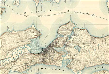
In the 1880s, the U.S. government set out to create detailed maps of the country, resulting in a series of topographical maps that can be viewed as both science and art. An exhibition of this rare cartography at the Harvard Map Collection features approximately 30 maps dating from 1885 to 1893. Cities like Boston and Seattle are represented but so too are Western mining towns and rural regions like Plaquemines Parish, La. These maps, many of them rare, represent early mapmaking experiments with contour depiction and the establishment of universal symbols. The exhibition runs Monday through Friday, 9 a.m.-5 p.m., at Pusey Library through June 30.