


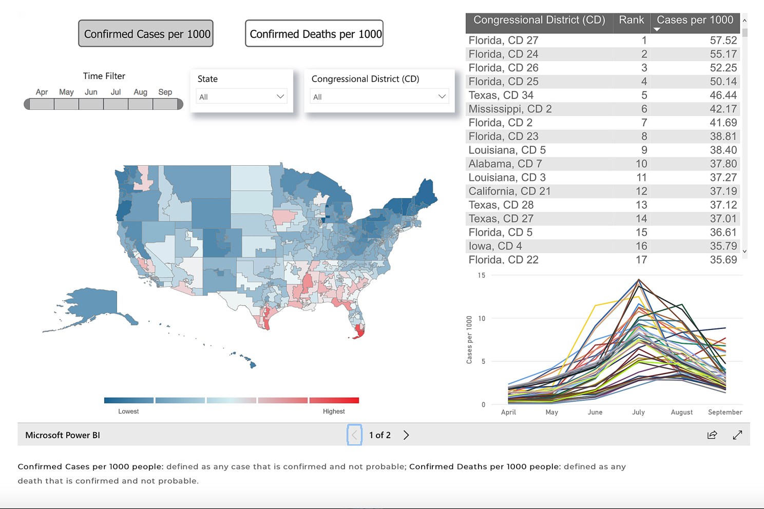
Researchers at the Harvard Center for Population and Development Studies and the Center for Geographic Analysis at the Institute for Quantitative Social Science recently launched a public dashboard for congressional representatives. The dashboard also includes constituents on key COVID-19 metrics for the congressional districts of the country, as identified by the 116th United States Congress.
Nearly a year into the global pandemic, data on COVID-19 metrics for the United States congressional districts have not been readily available. Yet, having access to such data can substantially enhance the ability of elected officials and the constituents they represent to monitor and develop testing strategies, vaccine deployment strategies, and other measures to allow their districts to open safely.
Nydia M. Velázquez, chairwoman of the Committee on Small Business and representative of New York’s 7th congressional district, underscored the importance of having COVID-19 metrics by congressional districts.
“This research from the Harvard Center for Population and Development Studies provides critical insight not previously available into how this pandemic is impacting different congressional districts across the United States,” she said. “Because of this information, the House Small Business Committee can better examine the efficacy of federal programs in reaching the areas most impacted by this virus. Data like this is critical to policymakers as it improves our ability to legislate changes that ensure aid is going to those that need it most.”
The Center for Geographic Analysis (CGA) at IQSS works with researchers across Harvard and beyond its campus to strengthen University-wide geographic information systems (GIS) infrastructure and services; provide a common platform for the integration of spatial data from diverse sources and knowledge from multiple disciplines; enable scholarly research that would use, improve, or study geospatial analysis techniques; and improve the ability to teach GIS and geospatial data science at all levels across the University. To learn more about CGA, visit: gis.harvard.edu