Campus & Community
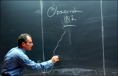
Software that rings in the future
A computer technology that already shows people what the world looks like has the power to help transform it into a better, more sustainable, and easier-to-manage place, speakers at a symposium on Geographical Information Systems said last month.
Begun as a mapping software decades ago, Geographical Information Systems, known as GIS, today functions to manage different time- and place-dependent data and allows different variables to be projected together, making for decision support systems and for vivid, sometimes revealing comparisons. Brightly colored maps can show everything from traffic patterns to global warming to animal migrations, and track changes over time, providing a lens through which researchers can easily view their data.
“We can communicate quickly, with real people, [about] complex systems using GIS,” said Jack Dangermond M.L.A. ’69, president and founder of ESRI Inc., the world’s largest company producing GIS products.
GIS was the focus of a conference held at the Science Center Nov. 20 as part of a worldwide GIS Day. The conference, according to organizer Lucia Lovison-Golob, a GIS instructor at the Harvard Division of Continuing Education, was designed to attract student interest in GIS.
GIS was first developed at Harvard in the 1960s by Howard T. Fisher, after whom the Howard T. Fisher Prize in Geographical Information Science for graduate and undergraduate students was established. Despite GIS’ early Harvard roots, it attracts little undergraduate attention at Harvard today, Lovison-Golob said. That, she said, is something the conference was intended to remedy.
Speakers at the event included Jim Hall from PlanGraphics Inc. and Jim Steiner from Oracle Corp. as well as faculty from seven Harvard Schools and departments. The speakers highlighted the increasing usefulness and dependence on GIS that has gone hand in hand with the rise of information technology. That dependence and the need for research on location-based, time-specific acquisition, management, storage, and visualization of data is likely to increase as GIS, along with cell phones, laptop computers, and global positioning systems, goes wireless.
Dangermond said that Harvard would benefit if it has a “locus” where people can exchange ideas and experiences on GIS. That would be a place where GIS support to the many Harvard constituencies can be provided, and where knowledge and skills in GIS technology can be integrated into different programs to foster a new generation of students and new lines of thinking on GIS.
Edward O. Wilson, Pellegrino University Research Professor, helped introduce the day’s speakers, saying that GIS has become a critical tool for biologists struggling to preserve the natural world.
“There is no technology more important than GIS to the protection and management of the environment,” Wilson said. “GIS is the tool of choice in mapping global biodiversity.”
Dangermond, the conference’s keynote speaker, presented a graphic demonstration of GIS’ usefulness. Projected onto a large screen behind him, an image of the Earth from space grew larger as he zoomed in, smoothly showing first continents, then countries in increasing detail until, in a matter of seconds, he had gone from outer space to individual terrain features.
This is possible, he said, because data is indexed according to place and time and then presented in graphical format. He likened the data to stamps that can be stuck to particular mapping technology, making it accessible and manageable. Dangermond predicted the rise of the Internet will help make GIS even more useful, as the transfer of data becomes faster and easier.
Managing data, he said, is critical to creating a sustainable society, able to live within the Earth’s increasingly limited resources. In order to use those resources wisely, he said, we need to know what they are, where they are, and what’s happening to them, data that GIS handles easily.
During his presentation, Dangermond showed brightly colored graphical representations that presented an array of data, from elephants moving in and out of Kenyan game parks to ozone pollution over Los Angeles to the slow depletion of aquifers under Kansas.
“GIS is already making a difference. People are using it to plan more carefully and strategically,” Dangermond said.