

Campus & Community
The romance of the road on display at Pusey:
Colorful exhibition of road maps dates from 1796 to the 20th century
Back in the technological dark ages, before travelers could download turn-by-turn directions prior to setting out for an unfamiliar address or switch on their Global Positioning Systems to help them find their way in a foreign city, motorists relied on maps, those fluttering sheets of paper that unfolded to the size of a bedsheet, contained a jumble of microscopic details unintelligible to the naked eye, and soon wore away to shreds and tatters of little use except to mop up spilled soft drinks from the floor mats.
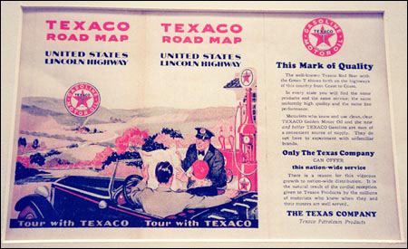
And yet there is an undeniable romance and attraction to these products of the cartographer’s art, enhanced perhaps by the fact that before the gas shortages of the 1970s, road maps were supplied free of charge at every filling station. Subsidized by the major oil companies, and often decorated with illustrations of wholesome Americans happily agog amidst scenic wonders, they helped to promote travel.
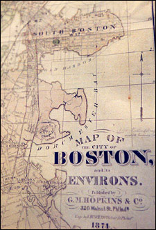
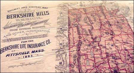
Because road maps developed and changed along with the automobile industry and the nation’s highway system, they are valuable documents in the study of 20th century American social history. The Harvard Map Collection in Pusey Library is presenting a generous sampling of that history in a new exhibition titled “The All American Road Map.” It will be on display through mid-January.
“What we’re trying to do is take people through all the changes that have characterized the development of roadmaps,” said David Cobb, director of the Map Collection and president of the Boston Map Society. “The exhibition takes you from the days before there were even road numbers up to some recent maps of Massachusetts.”
The exhibition was curated by road map collector and Boston Map Society member Peter Yensen. Yensen also wrote an essay on the exhibition that appears in the August issue of the Boston Map Society Newsletter.
The exhibition begins with a 1796 map of the U.S. showing early post roads, and proceeds through the early 20th century, when the automobile began to dominate road travel. It is surprising to discover how primitive the nation’s roads were less than 100 years ago. Largely unplanned, they constituted what Yensen describes as “a confusing hodgepodge of ‘blazed trails.’”
The Lincoln Highway, laid out in 1915, was to be the first paved transcontinental road, but for many years it existed only on paper. Government did not wake up to the need for road improvement until the Transcontinental Military Truck Tour, organized in 1919 to demonstrate the need for good roads to facilitate troop movement. The tour took more than 60 days to travel from Washington, D.C., to San Francisco.
A major turning point occurred in 1926 when the American Association of State Highway Officials adopted a scheme for numbering roads that, with some alterations, remains in use today. Road building accelerated during the 1920s, ’30s, and ’40s and private and commercial road travel became more common.
Road building and most non-essential automobile travel ceased during World War II, but in the prosperous postwar period, Americans took to the roads as never before, and public pressure for more and better roads eventually led to the construction of the Interstate Highway System, a federally funded project signed into law by President Eisenhower in 1956.
The energy crisis of the 1970s signaled not only the end of the free gas station road map, but a sharp decrease in road building as well. The billions in cost overruns expended on urban highway projects such as I-105 near Los Angeles and Boston’s “Big Dig” are probably a sign that the great days of highway construction are behind us.
The maps, however, remain – at least those that have not been rendered threadbare through repeated refoldings. And these artifacts evoke an era rich in history and nostalgia. You may never “see the USA in your Chevrolet” with quite the innocence and exuberance of your parents or grandparents, but this exhibition will help you imagine what it was like.