
Campus & Community
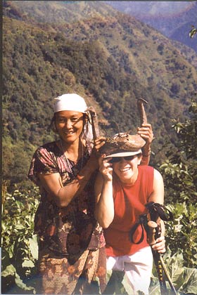
Ana Barros chases the monsoon
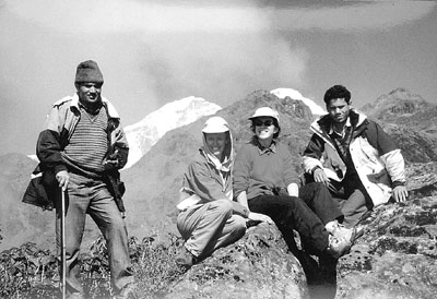
Ana Barros, a Harvard associate professor of environmental engineering in the Division of Engineering and Applied Sciences, also sees a kind of Holy Grail in understanding the torrential rains that baptize southern Asia anew annually. But she and her team aren’t chasing the monsoon; they simply wait for it to come to them, at more than 20 stations they have set up on three Himalayan ridges between the Nepali cities of Pokhara and Kathmandu.
And while they’re waiting, they have more than enough to do. They are measuring wind speed, air pressure, air and soil temperature, soil moisture, net radiation, rainfall, snow depth, and snow-water equivalent at altitudes from 500 to 5,000 meters. Why the Himalayas? Because they’re there, of course.
“The Himalayas are the largest mountain barrier on Earth,” Barros says, “and probably one of the least understood. If we can explain how climate, hydrology, and tectonics operate there, we hope we can develop a model that explains how they operate everywhere.”
The four-year project, which is the most comprehensive and systematic study of its kind to date, is being sponsored by the National Science Foundation. It brings together geologists, glaciologists, climatologists, thermochronologists, and others from seven U.S. universities, Grenoble’s Centre National de Recherche Scientifique, and three governmental agencies in Nepal to analyze and model the circular nature of climate as it relates to geomorphic processes – a term that has endless layers of meaning for everything from global warming to whether you should bring an umbrella to work tomorrow.
Barros, who is getting additional funding from NASA, says her team’s contribution to the project is to look at the spatial and temporal distribution of rainfall. That is, she is measuring not only how much rain falls – something that has never been accurately gauged in this part of the earth – but also when it falls, and the physical mechanisms associated with it.
“It’s very different if you have one meter of rainfall in a month,” she says, “than if you have one meter in a week. If you get lots of rainfall but it’s all drizzle, it doesn’t have a strong impact. But if it all falls in a short time, as in the case of the monsoon, it causes widespread erosion, landslides, and floods.” Without that erosion, Barros explains, the mountains, which continue to grow because of the shifting of tectonic plates, “could already have folded over themselves.”
Erosion, by changing the shape of the mountains, also affects the vertical and horizontal motion of wind and the formation of clouds, which determines the amount of precipitation that eventually causes more erosion. “Over a period of two days we get almost a third of the entire monsoon rainfall,” Barros says. “We are talking about rainfall intensities that are so high, they have the power to bring down a hill slope.”
Measuring the amount of rainfall accurately will allow researchers to derive the spatial distribution of latent heat, which is the energy given up or taken by the air when another substance, such as water, changes phase, as in the case of vaporous condensation becoming liquid rain. Understanding latent heat is critical to understanding circulation. “And circulation is the essence of climate and weather,” she says.
Because of the difficult access, there is no accurate historical record of precipitation amounts at an altitude of 2,000 meters, and no measurement at all above 2,000 meters. Even with today’s most advanced scientific equipment, getting high-quality data is no small task. “It’s really painful to go over there, set up stations, collect data, and make sure everything works all the time,” Barros says, “There are all kinds of things that can go wrong, and they all happen. But once we have the data, we can provide the quantities against which a model has to perform. And then we can use it in the Cascades, in the Rockies, in the Andes, anywhere.
“These days,” she continues, “global climate models cannot reproduce observed rainfall. And the problem with getting rainfall wrong in the models is that they’re really getting latent heating and associated states wrong.” This helps to explain why weather predictions are notoriously imprecise: What’s happening in the mountains has a huge impact on what happens in the valleys and plains in the vicinity of whatever range you’re talking about. And as for the larger picture, says Barros, “Studies have shown that snow deposition in the Tibetan Plateau affects the strength of El Niño, which affects weather patterns all over the world, including precipitation in the U.S.”
So, though spending several years gauging the deluge to the minutest degree on a 4,500-meter ridge in a remote corner of the Himalayas may seem an obscure pursuit, it will in fact have almost limitless practical implications. For the people of Nepal, particularly the overpopulated Kathmandu Valley, it may help to solve the enormous problem of sustainability, both for agricultural and water resources.
For the rest of the world, it will help scientists to predict weather on a global scale much better than they are currently able to do; it will also, by setting up accurate standards against which to measure, have implications for those studying global warming – and hence this seemingly small project will no doubt have some effect on anti-pollution policies in developed nations. Another big economic consequence will be in the area of power production: Once an accurate mountain-rainfall model is produced, communities worldwide can use it to engineer dams that are neither under- nor overdesigned – in other words, you won’t find out after you’ve finished your multimillion-dollar dam that it is too small, and that a lot of the water that constitutes your power source is escaping into spillways.
Barros, a petite woman with dark hair and bright eyes who says she got into engineering because her engineer cousin was having “the time of his life,” doesn’t worry too much about such weighty matters; she’s just excited about the matter at hand. “Working with the monsoon is ideal for a hydrologist,” she says, “Because everything is happening so fast. It’s just really fun for us.”