


Campus & Community
Ocean Weather Prediction System Developed
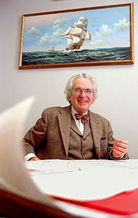
Oceanographer Allan Robinson stared at the front page of the newspaper showing where EgyptAir Flight 990 had plunged into the sea with 217 people aboard. He focused on a map illustrating a search for bodies and floating debris that was going on to the east of the crash site.
“I suddenly realized that they were searching in the wrong direction,” Robinson recalls. “The plane went down south of Nantucket Island off Cape Cod [Massachusetts], where the ocean current flows to the west, not east.”
Robinson should know. As Gordon McKay Professor of Geophysical Fluid Dynamics (the ocean is a geophysical fluid), he has been working on a system to predict weather within the oceans since the early 1980s. Computers in his laboratory at Harvard University are crammed with maps and models of the flows, temperatures, chemistry, and biology of watery depths and shallows around the globe. The year before the Oct. 31 crash, he and his colleagues had thoroughly explored coastal waters off Massachusetts in an effort to forecast the best places for commercial fishing.
From the newspaper article, Robinson went to the computer “sea” in his lab and quickly “seasoned it,” cooling water temperatures and adjusting winds to that days conditions. Storms were expected, and they would blow floating bodies and debris first west, then north, then back west. It was the kind of information that would make any search more effective.
Robinson contacted Congressman James McGovern of Massachusetts, whose staff relayed the ocean forecast to the Navy, Coast G uard, and the National Transportation Safety Board. Most of the floating and sunken remains of the victims and the airplane have now been recovered. However, what caused the New York-to-Cairo flight to dive into the sea at more than 750 miles an hour remains unknown.
HOPS to It
Robinson sees searches for victims of airplane and ship crashes as only one “product” tailored from a generic cloth that covers the global ocean from its tidal shallows to its cold, dark depths. He says that the Harvard Ocean Prediction System (HOPS) is the first practical system that can be deployed to any region of the world ocean to provide instant forecasts of ocean weather, as well as information about creatures from whales to single-celled floating plants.
Portable computers containing virtual models of a region are quickly updated with information from ships, airplanes, satellites, and unmanned submarines, providing what the Harvard team calls a “nowcast.” As the new data is added to the generic model, forecasts are produced in a form ready for use by naval commanders, fisheries managers, and rescue crews.
“We assimilate yesterdays data into todays forecast of tomorrows weather in the ocean,” Robinson notes. “Real time, at-sea forecasts have been carried out for more than a decade at 20 sites in the Atlantic and Pacific oceans and Mediterranean Sea.”
These forecasts have been used for avoiding “enemy” submarines and mines during naval war games, predicting the fertility of coastal and open-ocean waters, understanding the oceans input to global warming, and even tracing the route of a dead whale.
An endangered northern right whale, named Staccato, was seen alive in Cape Cod Bay in April of last year. Five days later, its floating carcass was spotted about 15 miles away. The animal had presumably been hit by a ship. Its against the law to kill a whale; if a ship hits one accidentally, the captain must report the incident immediately. Therefore, law enforcement agencies enlisted Robinsons help to see if Staccato had crossed the path of any ships since the time it was last seen alive. In this case, HOPS had to produce a hindcast rather than a forecast.
Hiding in the Ocean
The ability to tailor a general forecasting system to such specific tasks has been enhanced by applying HOPS to solving problems for the U.S. Navy. During the Cold War, for example, the system was used for finding Soviet submarines hiding behind deep-sea weather fronts.
In 1986, the Soviets sent more nuclear attack subs into the North Atlantic than U.S. naval intelligence had seen before. The Navy began tracking their paths as it had been doing for years. During the succeeding weeks, however, the Navy lost track of several subs moving off the coast of the northeastern United States.
Concerned, the officer in charge of surveillance called for the best expert available. He got Robinson.
“It was immediately apparent what was happening,” Robinson remembered. “I not only can tell you what the problem is,” he advised the Navy, “I can find the holes in the sea where subs could be hiding.”
The Gulf Stream, a powerful river embedded in the ocean, carries warm water from Florida to Canada then eastward to Europe. On its way, this ocean river meanders widely and throws loops of warm water into the colder surrounding ocean. Underwater sound waves used to detect submarines are bent at fronts where warm and cold waters meet in such a way that Soviet vessels could hide in the eddies much like a tank can hide behind a hill.
To demonstrate how the United States can take that tactical advantage away from its enemies, Robinson and his team boarded the aircraft carrier USS Forrestal during war games in which U.S. subs tried sneak “attacks” on surface ships by using warm eddies as cover.
Planes from the Forrestal dropped instruments in the ocean that measure changes in temperature with depth. Put into HOPS, that information allowed the Navy to “see” the “hills” and “walls” behind which its enemies could hide. Ship commanders then planned their maneuvers accordingly.
When the commanders saw how HOPS improved their “kill ratio” of submarines, they gave it a new Navy name and adapted it for their own needs. Thats OK with Robinson. He emphasizes that no confidential military work was or will be done on the Harvard campus.
Spring Blooms in the Ocean
During the past few years, Robinsons team has been integrating biology into HOPS forecasts. The ocean undergoes a spring bloom much like that on land. At this time, changes in winds and water circulation hold nutrients close to the surface, where the increased sunlight drives vast quantities of one-celled plants to grow and reproduce.
The plants provide food for floating armies of small sea animals that look like tiny shrimps and worms. Such plankton, as the plants and animals are called, provide vegetables and meat for the rest of the marine community from anchovies to giant tuna and whales.
The beginning of this annual life cycle is heralded by changes in water color. Patches of green identify places where plants are turning sunlight and carbon dioxide into sea gardens. Putting information about colors, chemicals, and temperatures into HOPS produces forecasts of where spring blooms will occur and how extensive they will become.
Robinson and his colleagues and students proved the value of this technique in the open Atlantic in 1997. The next year, along with researchers from other universities, industry, and the government, they used satellites, airplanes, ships, and unmanned submarines to gather data and make the most detailed forecasts to date of what goes on in coastal waters off Massachusetts. This year, another research fleet will go to sea to predict such things as the location and abundance of he rring and cod off the northeast coast of the United States.
Such practical operations include research efforts to help understand how the ocean interacts with the atmosphere to change weather and climate. One question HOPS can shed light on is the role of the ocean in absorbing carbon dioxide from the air, and the effect on global warming of removing this greenhouse gas from the atmosphere.
“Our work is about half fundamental research and half applied forecasting,” Robinson explains.
Both ways, HOPS is contributing to a new view of the ocean as a place with as much weather as the atmosphere. HOPS is the first and most advanced of many systems now beginning to reliably track and forecast what goes on under the 70 percent of Earths surface covered by water.
When you think about it, “Oceanus” would be a better name for the planet than “Earth.”